It took my train 27 hours to reach Vancouver, BC. This is the longest I’ve ever been on a train. But despite delays, I enjoyed my trip. Vancouver is a beautiful city and I spent some of my time on a suspension bridge hundreds of feet in the air. Not for the faint of heart.
Canada Part 3 - On the most beautiful mountain road can be found here.
My next stop in Canada was Vancouver. I had decided to take the train as I wanted to enjoy the scenery without having to focus on driving. I had this romantic image in my mind of the train passing through the Rocky Mountains. And I wanted to see what came on the other side.
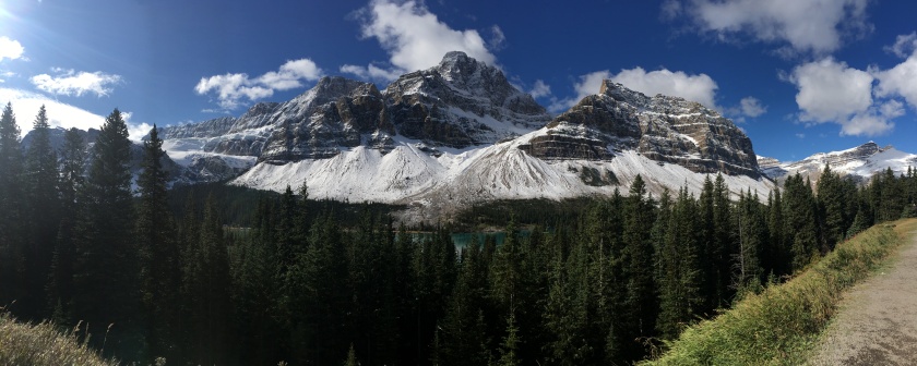
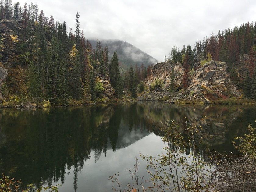
Photo taken during my drive along the Icefields Parkway in Alberta
It’s over 700 miles (~1,100 km) from Edmonton in Alberta. That is about 27 hours on a Via Rail train.
I had decided to start train journey from Edmonton, instead of Jasper, so that I would see the scenic views on both sides of the latter. Alas, it did not quite turn out this way as my train was delayed by eight hours. So instead of travelling through the Jasper area at midday, we got there at midnight. I guess that can always happen when you travel by rail. (You just always hope it isn’t your train.)
Similar to the U.S., a Canadian passenger train needs to let (the long) freight trains pass. So we would occasionally stop somewhere for 30 minutes to wait for that to complete. This prevented our train from making up time, except during the night. Although, maybe it was the area that we passed. But at some point, we were 11 hours behind and it then reduced back to “only” eight.
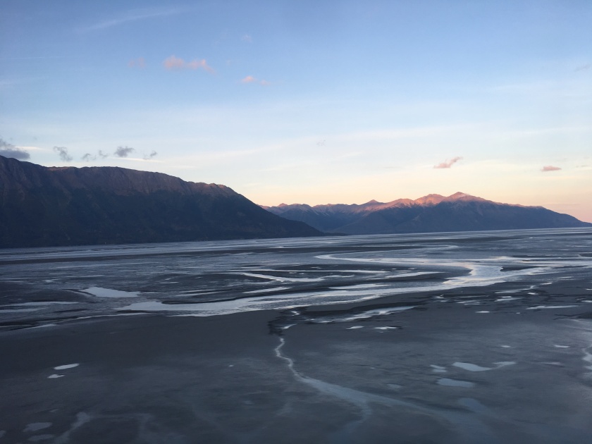
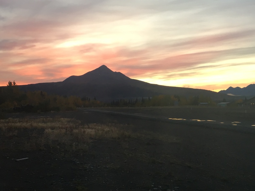
Sunset from the train – still in Alberta, CanadaThe other side of the Rockies – it reminded me a bit of Texas but I believe that may just be as it’s my closest reference point for where I’ve traveled in the U.S.
Even with the delay, I enjoyed my journey. The train was comfortable and I had the space to spread out while sleeping. I could walk around on the train and we had a bistro / restaurant along with a panorama carriage with its glass ceiling. Though, I still prefer large regular windows on the side. There is just something about the panorama carriages that makes me uncomfortable. (Silly, right? Please do try it yourself as you might feel differently. There are plenty of trains with similar panorama carriages in many countries of the world, e.g. my Alaska train, the Glacier Express in Switzerland, a train in Japan, etc.)
Canada has its own version of the Whistle stop. This is a “regular” stop but only if someone gets off.
All this being said, I added the Rocky Mountaineer to my bucket list. It’s a Canadian train traveling experience where you get the breathtaking views in a luxurious environment. And, depending on route, you get to spend a night in one of the grand railway hotels. Something else that I’d like to do one day.
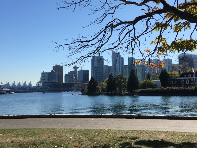
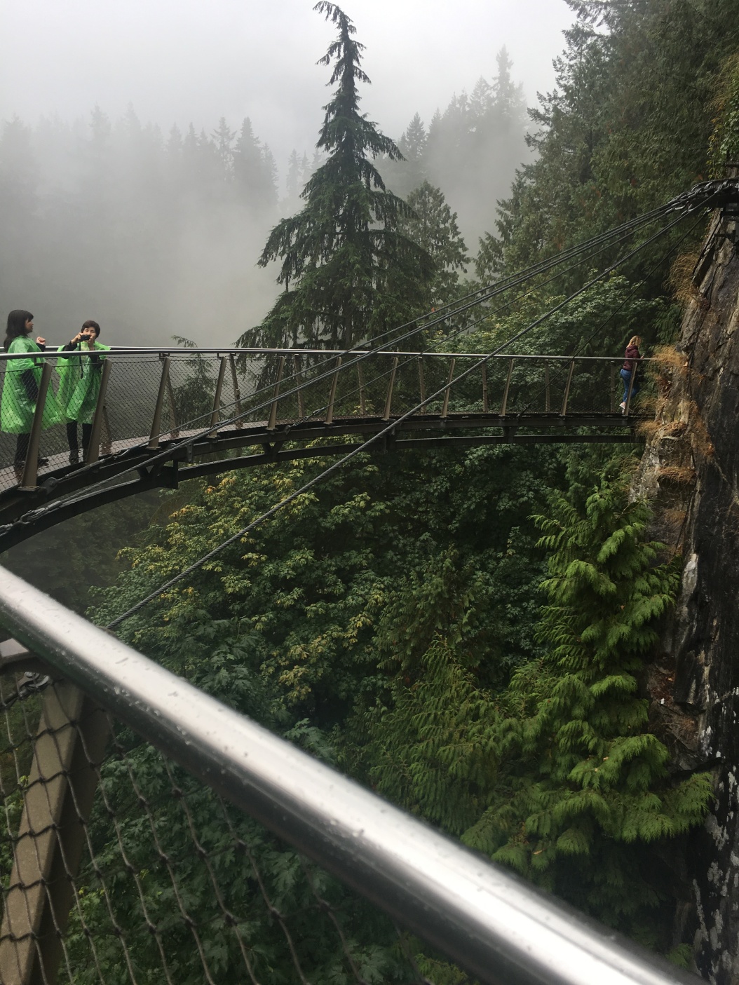
Vancouver was pretty and the weather on my first full day was gorgeous like on a height of summer day. Unfortunately, with the train delay my 2.5 days became only two days of visiting. So I didn’t get a chance to go to Vancouver island. But I made it across the bay to the Capilano Suspension Bridge.
Vancouver’s float plane port with Stanley Park in the backgroundVancouver Downtown – photo taken on my bike trip around Stanley Park. With the weather being so nice, biking turned out to be a really nice way to explore the center of the city.Does this look familiar? It was used in a Batman movie or the Gotham TV show. I forgot which one. Lots of filming happens or happened in Vancouver, including for example The Man in the High Castle.The Capilano Suspension Bridge in the BC rain forest . It’s 460 ft (140 meters) long and 230 ft (70 m) above the Capilano river. Unfortunately, there was a lot of rain on that day too. But that didn’t stop me. And it probably helped by reducing the visitor numbers.Imagine the bridge swinging under your steps as people cross – There has been a suspension bridge here since 1889. The current bridge is a feat of engineering. In 2006, a 300-year-old, 46-tonne Douglas fir tree toppled during a heavy snowstorm and fell across the western end of the bridge. And the bridge held. The tree had to be removed by getting cut into small piece. If it would have been removed in one go, the bridge would have snapped upwards like a rubber band.The Treetops Adventure in the Capilano Suspension Bridge Park – you walk “from one magnificent Douglas-fir tree to another on a series of elevated suspension bridges, some reaching as high as 110 feet (33.5m) above the forest floor.” (quoted from here)And the Cliffwalk – you walk on wooden planks but you can see that the railings are all see-through. You are up to 300 ft above the river.
This visit to Vancouver completed my roughly two weeks of travel through Canada. And with October beginning, I started my adventures in the Pacific Northwest.
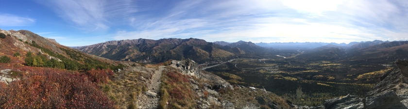
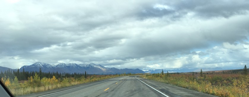
The Icefields Parkway between Banff and Jasper in Alberta, Canada is one of the most beautiful mountain drives in the world. It has lots of lakes, waterfalls, glaciers, and craggy mountains to admire. There is beauty around every corner, as cliche as that may sound.
Canada Part 2 - Dinosaurs in Alberta can be found here.
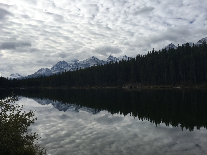
My first trip to Banff was a bit of a disappointment. During the ninety minute drive from Calgary I never got a good view of the Rocky Mountains rising majestically in the distance, instead all I saw were clouds hanging low in the sky so it seemed like the rolling foothills just continued into the distance. This is a bit of a case of not meeting high expectations as Lake Louise, and Moraine Lake later on that day turned out to be very scenic. I can only imagine how busy this region gets during peak season. Even in mid-September, the little town of Banff was still quite overrun with people (maybe because of the drizzling rain?). And there were plenty of tourists at the lakes, even a mile out on the walk along Lake Louise’s shore.
In Banff, I enjoyed a walk to the Bow Falls and let my imagination run wild about what the river crossing used to be and who would have been a visitor back in the 1880s.
It is a theme that the railroad is bringing not just settlers but also visitors, some might even say, first tourists. However, then further travel wasn’t easy. E.g., there was a whole industry of outfitters and guides. Lots of Swiss mountain guides came here from the Alps.It is amazing what Grand Hotels the Canadian Pacific Railway built, for example, the Banff Springs Hotel.
Below are two pictures of the Bow Falls. This is on the same Bow river as flows through Calgary. Like many rivers and streams in this area, the Bow originates in a glacier by the same name. (Unless they get the origin wrong which happened with the Athabasca River. It comes from the Columbia Glacier which is connected to the icefields the parkway is named after.)
Everyone has probably seen pictures of the famous Lake Louise. It’s well known for the amazingly blue color of its water. And for the Chateau Lake Louise, one of Canada’s grand railway hotels, that is built on its shore.
The emerald color of the water of Lake Louise – which wasn’t as distinctive given the weather – comes from rock flour carried into the lake by melt-water from the glaciers that overlook the lake. Most lakes and many rivers in the region show the same color as they are all fed by glaciers.
My favorite that day was Moraine Lake, maybe because of the amazing peaks that finally became visible when the clouds receded. A view of Moraine Lake is featured on the back of the Canadian twenty dollar bill.
A few days later I had more luck with my drive from Calgary to Banff as the weather had much improved.
The Rocky Mountains finally rose in the distance on the drive from Calgary to Banff. I had started early that day as I had to cover a lot of distance to get to Jasper.
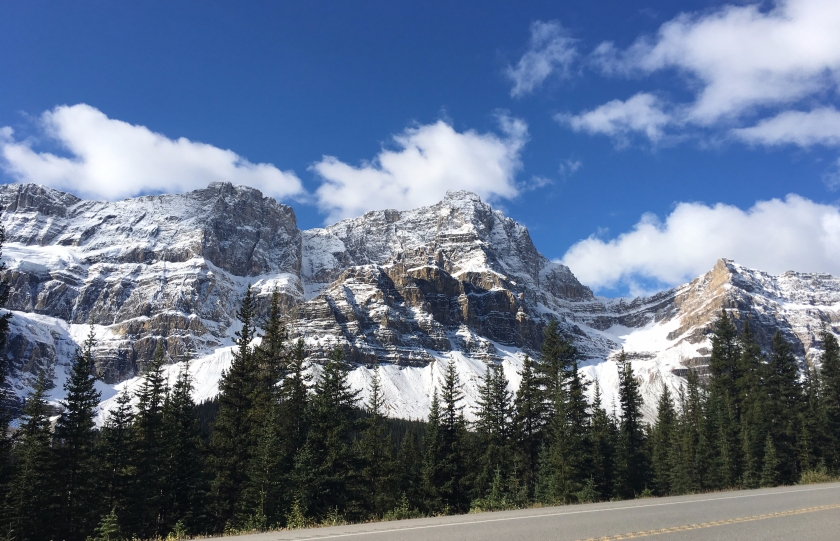
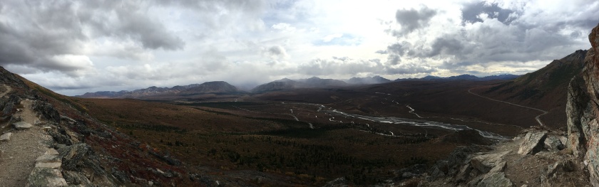
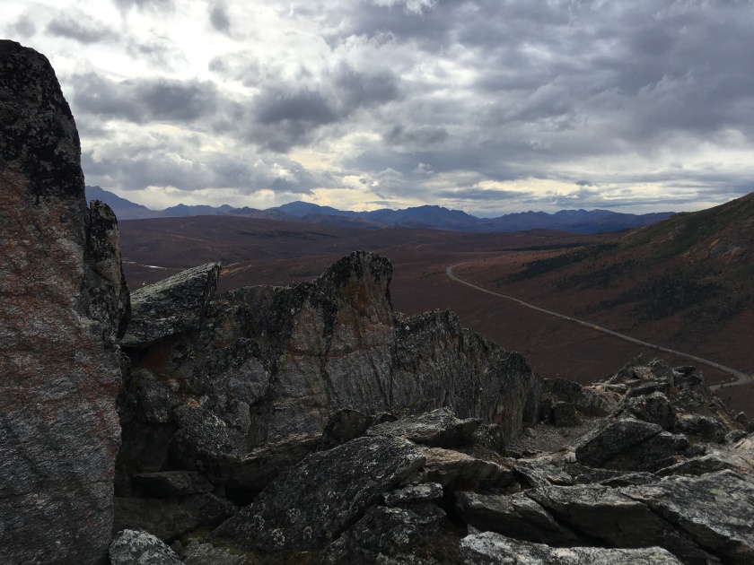
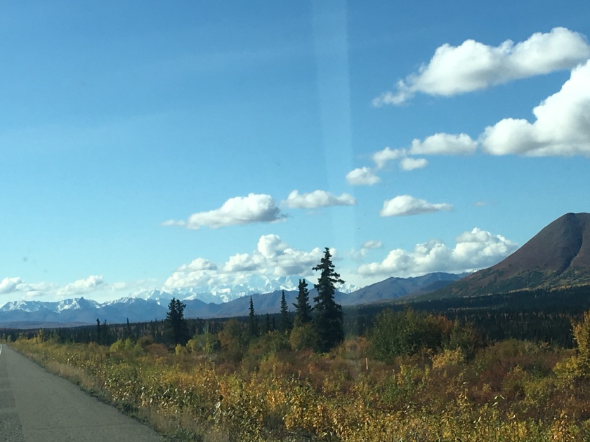
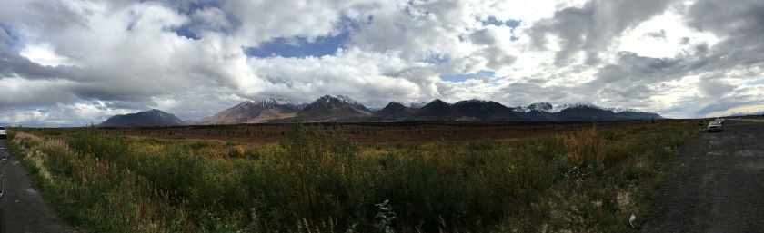
The Icefields Parkway between Banff and Jasper is a truly spectacular drive. It has been describes as the (or one of the) most beautiful mountain drives in the world. It is an easy drive (other than probably lots of tourists in the summer). There is only maybe two switchbacks at the one point where major elevation is gained in a short time. Points of interest are easy to get to, often not very far from the road.
For most of its 140 miles (227 km) length the Icefields Parkway travels “almost parallel with the Continental Divide. That’s why they say a drive on the Parkway is like driving on the backbone of the North American continent. The Icefields Parkway, named after the Columbia Icefields, is also known as Highway 93.” (quoted from here which also includes a map of the parkway)
The drive is highlighted by lakes, glaciers, and craggy mountains. And not to forget, a number of impressive waterfalls.
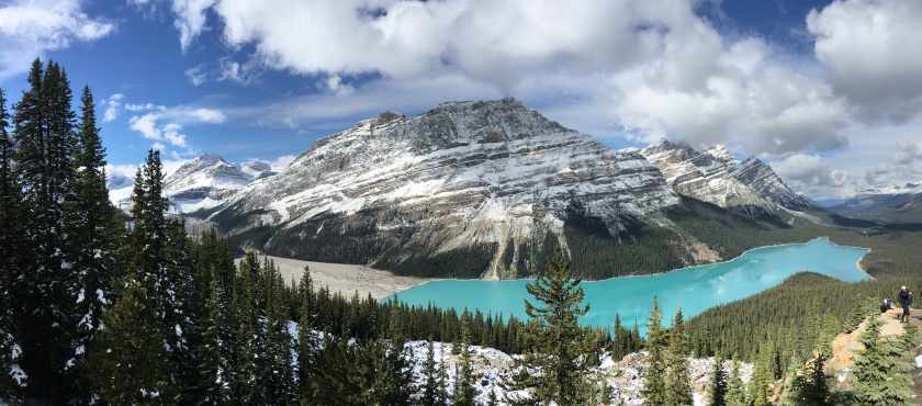
Peyto Lake and the part where its glacier used to be but has now receded out of sight of the picture. I was walking through snow and ice to get to my viewpoint. Which maybe shouldn’t be that surprising in late September in the Rocky Mountains.
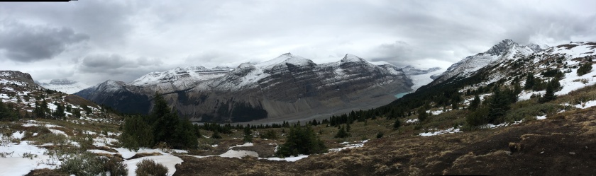
View from Parker Ridge at the Saskatchewan Glacier – I don’t remember ever before hiking through so much mud (or another way of looking at it, thankfully, the snow had melted). But the view was worth it. This one is about a two hour hike from the Icefields Parkway, though.
A few days later I had more luck with my drive from Calgary to Banff.
The Rocky Mountains finally rose in the distance on the drive from Calgary to Banff. I had started early that day as I had to cover a lot of distance to get to Jasper.
The Icefields Parkway between Banff and Jasper is a truly spectacular drive. It has been describes as the (or one of the) most beautiful mountain drives in the world. It is an easy drive (other than probably lots of tourists in the summer). There is only maybe two switchbacks at the one point where major elevation is gained in a short time. Points of interest are easy to get to, often not very far from the road.
For most of its 140 miles (227 km) length the Icefields Parkway travels “almost parallel with the Continental Divide. That’s why they say a drive on the Parkway is like driving on the backbone of the North American continent. The Icefields Parkway, named after the Columbia Icefields, is also known as Highway 93.” (quoted from here which also includes a map of the parkway)
One recommendation I have, if you ever take this drive, use the GyPsy app. It’s like having a tour guide right in your car. You can use it, even if you don’t have connectivity in Canada. It was a great app as it ensured that I stopped in the right places.
The drive along the Icefields Parkway is highlighted by lakes, glaciers, and craggy mountains. And, not to forget, amazing waterfalls.
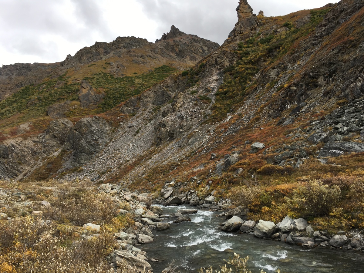
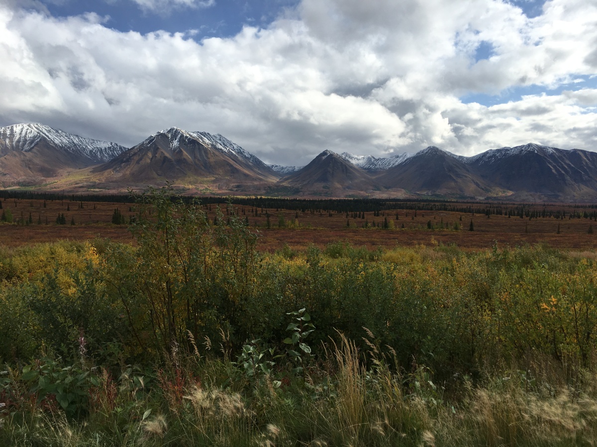
Peyto Lake and the part where its glacier used to be but has now receded out of sight of the picture. I was walking through snow to get to my viewpoint.View from Parker Ridge at the Saskatchewan Glacier. I do not remember ever before hiking through so much mud (or another way of looking at it, thankfully, the snow and ice had melted for at least part of the way up) – but the view was well worth it. This was about a two hour hike from the Icefields Parkway, though.View of one of the Five Lakes on the hike by the same name which is really close to JasperView of another of the five lakesI’m not sure which lake is peaking through the trees. But I also loved the view of the peaks.View of Castle Mountain – one of the other people taking a picture told me that they’d just seen a bear a few minutes ago at their previous stop. (Un)Fortunately, when I got there, it was gone. Overall, I saw almost no large animals in either the Banff or Jasper National Parks. I most remember the one black bear that I spotted from the car for a few seconds in passing.View of Storm Mountain – during my long railroad trip, I would pass on the tracks below. Given the delay of the train, this unfortunately occurred in the dark of night.View of the mountainscape somewhere before Peyto LakeView of a glacier above the Columbia Icefields (the white in the bottom right corner) – the weather wasn’t too great that day so I unfortunately don’t have any amazing pictures. You can go onto the icefield or walk to the toe of it (more or less)Upper Sunwapta Falls – I went on a nice short hike to the lower falls as well (shown below)
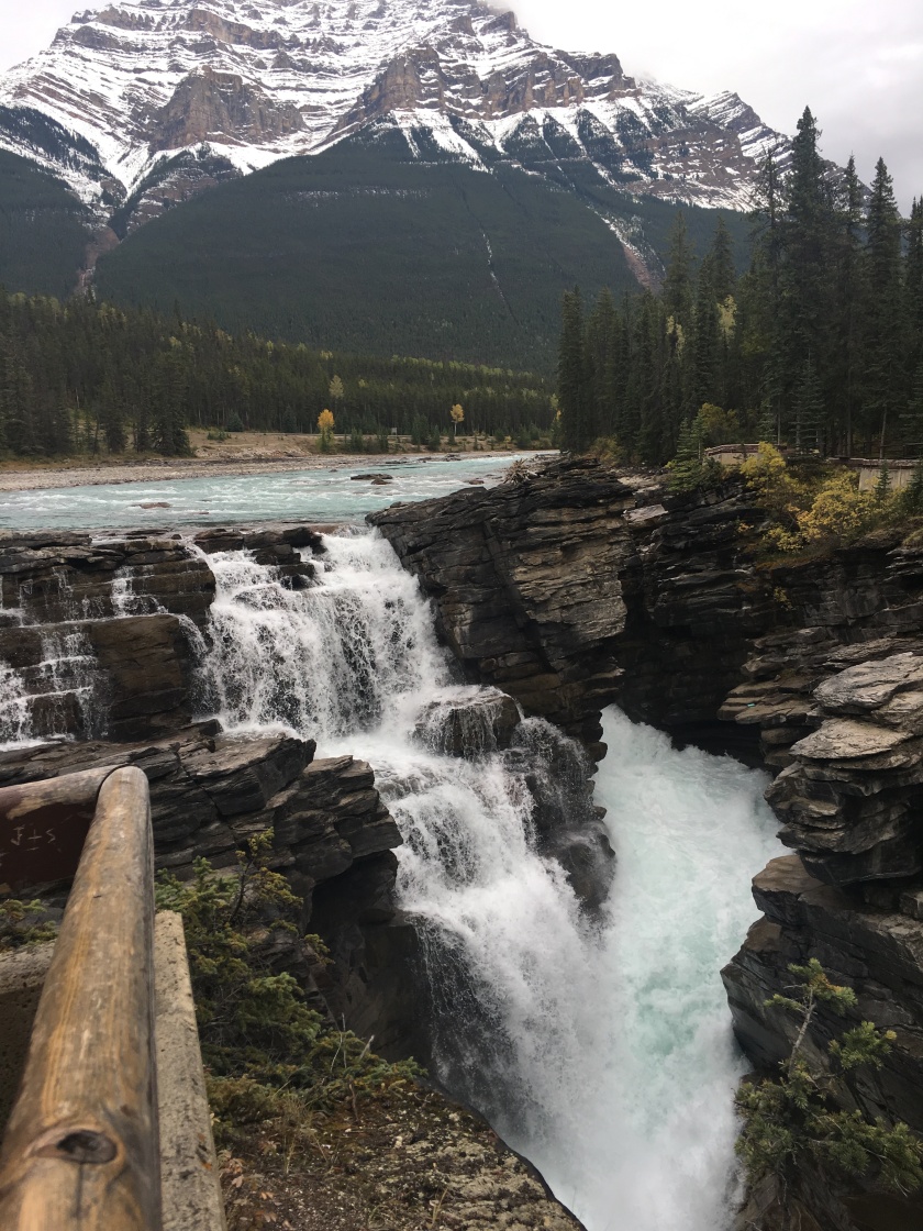
Athabasca Falls – I love waterfalls and seeing the power of water, either as it rushes over the edge or leaves massive carvings in the rocks behind.
I took a full day driving from Banff to Jasper with additional day trips back south from Jasper. It’s all just too much to see in one day. And, unfortunately, I got tired even of so much beauty. It was just easier to appreciate again the next day.
Taking four to five days for the sights on the Icefields Parkway felt about right. Of course, if you want to do a lot of hiking or are into nature photography or, for example, bird watching, you might want to consider planning a longer trip.
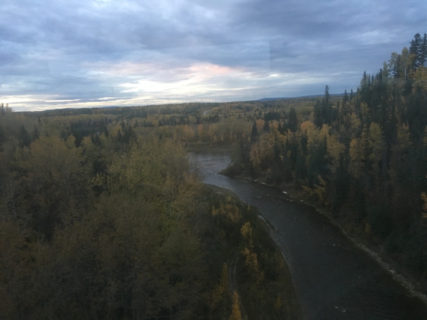
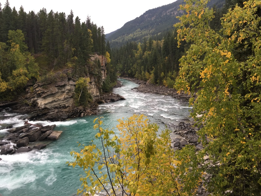
View of the Fraser River below the Rearguard Falls in British Columbia (not on the Icefields Parkway) – it’s not just Banff and Jasper NPs in Alberta that are amazingLake in Mount Robson Park in BC
Canada Part 4 - A train ride to Vancouver and the rain forest is here
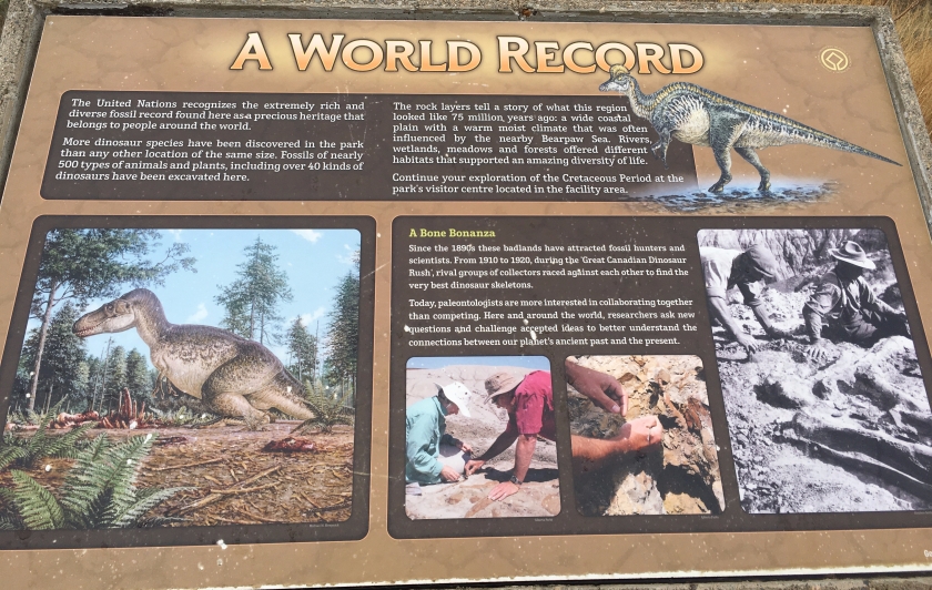
Did you know that Alberta is a treasure trove for fossil hunters? It has the largest concentration of dinosaur bones in the world. They are on display at the Royal Tyrrell Museum or can be found in-situ in the badlands of the Dinosaur Provincial Park.
The weather in Canada interfered a bit with my plans. Given a forecast of snow for Banff, I spent a couple of days avoiding the Rocky Mountains and went east to see dinosaurs instead. It was well worth it.
I had known there were dinosaur fossils in Alberta but I hadn’t realized the abundance of them. And how easy it was to go see and, in some instances, even touch them.
Before I got to the dinosaurs, I had to drive a couple of hours through the prairie. Some may find that very boring. Miles and miles of flat grassland or fields. Roads that go straight seemingly forever. And the very rare house, always hidden behind a screen of trees to keep out wind and weather.
A view of the prairie in Alberta
I actually found it interesting to drive across the prairie. There was something to the quality of light that added atmosphere to the views. Also, leaving early in the day and driving east towards the rising sun was special. (Unfortunately, I missed the actual sunrise as I didn’t get up early enough. And only took pictures in the afternoon when it was overcast.)
However, imagine my surprise when the prairie then suddenly opens up into this …
The Badlands (here a view of Horseshoe Canyon) – as you are approaching, you don’t see any of this as it is created by erosion cutting into the prairie. So these spectacular views are sprung on you as the land opens up. – Earlier travelers called these areas “bad lands to travel” as distance was deceptive and it was very easy to get lost.
There are two different (main) places for seeing dinosaurs in Alberta – the Royal Tyrrell Museum in Drumheller and the Dinosaur Provincial Park near Brooks. I spent a day at each. They were impressive in different ways. The museum had the more typical bones and exhibits. And who doesn’t like to look at to-scale dinosaur skeletons? However, the museum also had some unique findings.
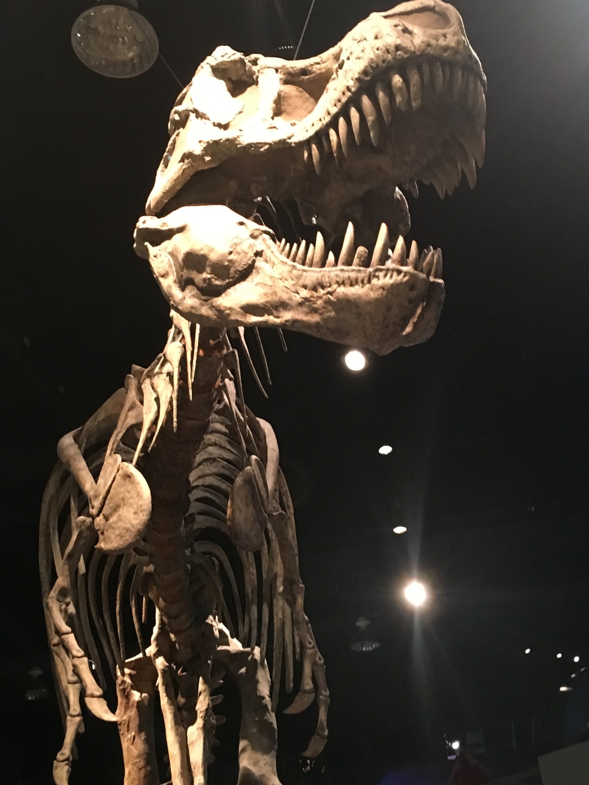
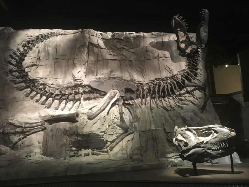
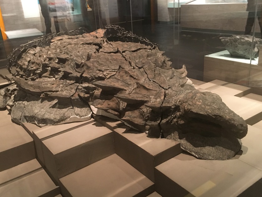
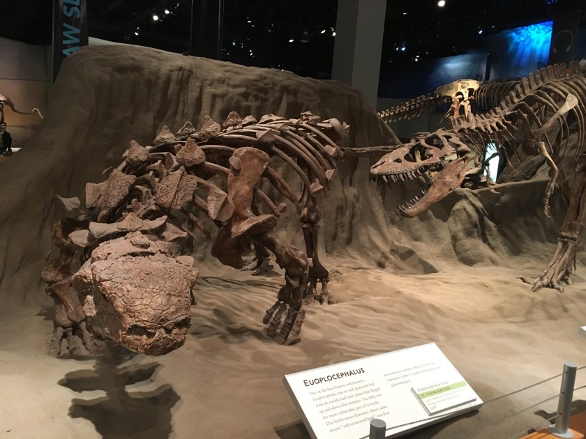
This is the very first exhibit upon entering the museum. The life-like setting gives the sense that you are right there with the dinosaurs.Everyone recognizes this dinosaur, right? It’s a huge T. Rex.This T. Rex is also known as “Black Beauty” due to the color of her bones, which were darkened by the element manganese in the water during fossilization. The skull is too heavy to be mounted in the pose. And it also needs to be accessible to researchers. So the model includes a cast of the skull. While the actual fossilized skull can be seen in the front at the right.These are the remains of the best-preserved armored dinosaur in the world. It is also the oldest known dinosaur ever found in Alberta – at least 35 million years older than any of the hundreds of dinosaur fossils known from southern Alberta. It is a new genus and species of nodosaur. It took six years of painstaking reconstruction to prepare it for the exhibit. And it was only put on display earlier in 2017. I’m glad that I was able to see it.A number of the exhibits are arranged in more “action-like” scenes. There is a huge hall full of exhibits like this. Go take your kids and see this, if possible.
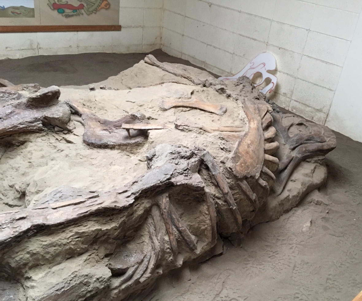
All the bones displayed at the Royal Tyrrell Museum come from the Dinosaur Provincial Park. But I wasn’t quite sure what to expect from the park. I booked an Explorer’s Bus Tour. There are also hikes and walks available into the part of the park that isn’t open to the public. My bus tour took about 90 minutes and in addition to stunning views of the badlands, we visited an in-situ Hadrosaur dinosaur display. And a Corythosaurus.
The Hadrosaurus — Thirty years ago, when they put the plexiglass on, the sand reached the top of the side rim. That’s a lot of erosion.The Corythosaurus had been moved thirty feet from where they’d found it so that they could preserve it …It was housed in a building and “open”, i.e. not under glass. While we couldn’t touch it, the guide had other related fossils that were handed around. I had difficulty processing the age of what I was touching. A tooth from a million years ago? Wow.
Fossils are just everywhere (when you know what to look for). Our guide pointed out bones literally on the ground in front of us. I would have walked past them, thinking they were stones. It takes a lot of practice to recognize fossils. But in the Alberta badlands, they keep finding them due to erosion.
They also have found so called bonebeds, thousands of bones in one place as hundreds of dinosaurs died at the same time. There is some speculation if it happened as part of a flood or for other reasons. It’s all just fascinating.
We also saw a camel. Well, sort of.
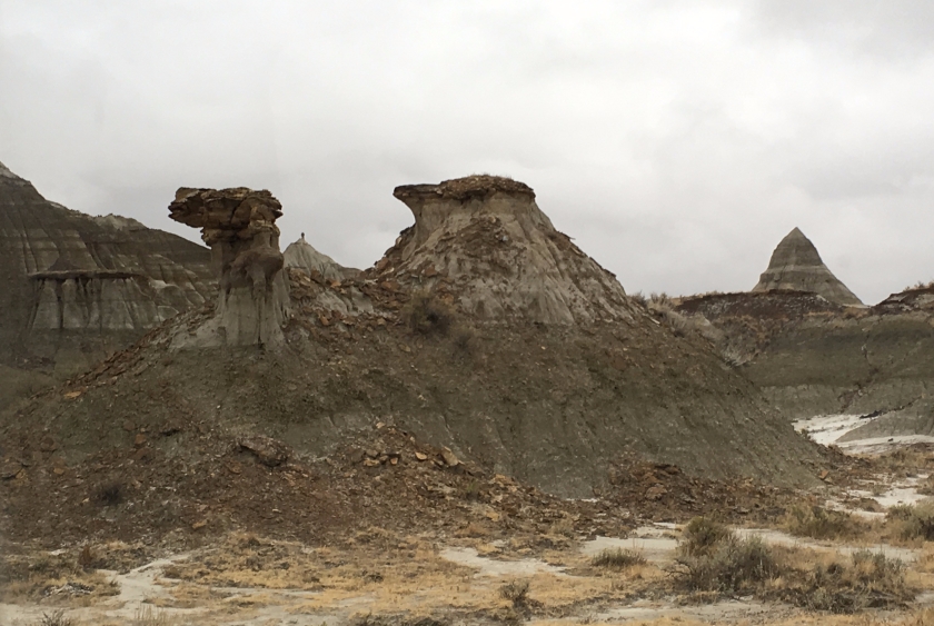
The camel — I had never heard of “hoodoos”. They are eroded pillars of soft rock topped with mushroom-shaped caps. The hard rock caps protect the softer pillar from eroding as quickly as the surrounding rock.
And hoodoos were everywhere in the badlands.
Going back to the dangers of the badlands, here you see some of the clay-like hills. They run and get slippery when it rains. Still, I found the austerity of the badlands very beautiful.
And then on the way back to Calgary, I came across this suspension bridge. I couldn’t resist crossing.
The 384 feet (117 meter) long Star Mine Suspension Bridge – originally built in 1931 and used until 1957 by miners, later rebuilt for public use and to commemorate the mining past.
Canada Part 3 continues with the most beautiful mountain road in the world.
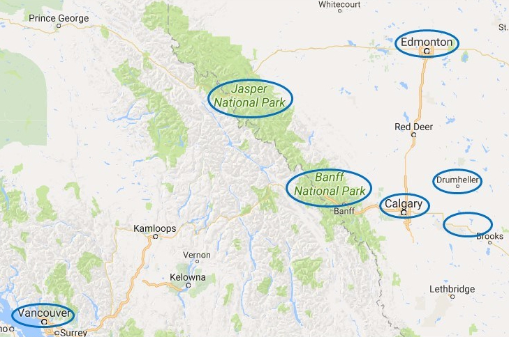
I spent the next two weeks traveling around Canada. Calgary became my base for trips into the prairie and badlands, and to the Rockies. But first I spent a day in the city.
After my two weeks in Alaska, I flew south to Canada. It is strange to think of Canada as being “south” of anything. But Anchorage is actually further north than even the northernmost border of Alberta, the province that includes Calgary where my Canadian travels began. Most of you will probably remember this city from the Winter Olympics in 1988. The ski jump from that event can be seen quite prominently from various parts of the city.
I started my Canadian adventure in Calgary, Alberta. The city became my base for day trips into the prairie – and to the dinosaurs – to the East and to the Rockies in the West. I then drove the entire Icefields Parkway, the most beautiful mountain road in the world, between Banff and Jasper. (And it was amazing.) I took a 27 hour long train ride from Edmonton to Vancouver, and spent a couple days in Vancouver before starting my next adventure in the U.S. Pacific Northwest.
I only spent one full day exploring Calgary itself and then used the city as a base for day trips. During that one day, I walked through a few of the city’s many parks, strolled along the river promenade following the Bow, one of the city’s two rivers, visited Fort Calgary, a museum, and went up Calgary Tower for a scenic view of the surroundings.
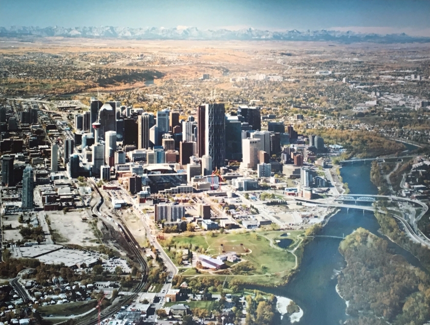
A dated aerial view of Calgary from the museum. Fort Calgary is in the foreground – in the middle of the green lawn. Then you see Downtown, with the Calgary Tower towards the left (look for red), and the outskirts of the city. In the background are the foothills of the Rockies with the mountains themselves impressively showing themselves on the horizon. The weather during my visit wasn’t quite as nice so my views of the Rockies were covered a bit more in clouds.If you look in the non-Rockies directions, you see miles and miles of prairie surrounding Calgary. It’s so flat! – In the foreground on the left is part of the Calgary Stampede, the building that hosts the annual rodeo, exhibition and festival by the same name. It’s a huge event.View down from Calgary Tower (only one small section has a glass floor) – standing on the beam felt safer. They say the glass can hold a couple of hippos but tell that to my lizard brain.
I enjoyed my visit to Fort Calgary. I’m always interested to learn about the local history. (And when I go to a museum, I try to read all of the descriptions and explanations.) The predecessors of the Mounties built the original fort after arriving in the area to stop the US whiskey trade and protect the fur trade. The arrival of the railroad in the 1880’s enabled the fledgling town to become the center of Canada’s cattle marketing and meatpacking industries. The discovery of oil in the early 20th century led to Calgary growing into the metropolis it is today. The importance of the energy industry is reflected in the city’s motto of “Be part of the energy”, but it also stands for the city’s vibrancy. With over 1 million inhabitants it is the fifth largest metro-area in Canada.
Just to imagine the scale of the slaughter of the buffaloes. This is a large pile of their skulls.
It was interesting to see that Canada deals with its past very openly. The Fort Calgary exhibits were distinctly apologetic around the treatment of the natives. The cattle-related industries saw the buffaloes passing across the prairies as a threat and eradicated the herds within a very short time and, thereby, destroyed the basis of living for the people of the First Nations.
One of Calgary’s parks had a monument to the treatment of the Chinese who were subject to a discriminatory head tax and immigration restrictions after the completion of the Canadian railroad. The Chinese had paid a heavy price for the building of the railroad. They were paid significantly less than their coworkers and were often given the most dangerous jobs, leading to many of them dying.
And later during my travels, I saw a historic marker of acknowledgment of the treatment of Japanese Canadians during WWII who were put into camps and were used as labor to build some of the roads crossing the Rockies.
By acknowledging the history and keeping the memory alive, it is less likely to be repeated.
Acknowledgment of the treatment of Canadians of Japanese ancestry
Canada Part 2 - Dinosaurs in Alberta can be found here.
Seward and the Kenai Fjords National Park finished off my time in Alaska. It started with a scenic railroad trip and continued with a six-hour cruise. The glaciers were amazing.
And then on my last weekend in Alaska I attended their annual Writers Conference. The timing was just too good to miss.
Part 3 - Anchorage and Whittier may be found here.
This is the final post in my Alaska series. It was quite the full two weeks.
I wrapped it up with something that I would recommend to every Alaska visitor: taking a train ride with Alaska Railroad. I had decided on the four hour trip from Anchorage to Seward. Sometimes the tracks are right besides the highway (between the road and the waters of Turnagain Arm; and located quite lower – so they will get flooded occasionally). Then there is also a part of the journey where the railway leaves the road and goes off “into the wild”, to places you normally don’t get to. And it’s just really scenic. And because the train to Seward leaves really early in the morning, it gets even better.
Yes – you’re seeing icebergs. This is a lake at the bottom of a glacier.
There is even a tour guide on the train. Alaska Railroad has a program for high school junior and seniors to become such guides. They receive a semester of training. And there really is nothing to differentiate them from older professionals.
A convenient S-curve so I (and everyone else on the train) could snap a picture of our engine in front of a glacier
Alaska Railroads has so called whistle stops. These are small stations (or sometimes not even that but only a sign) at which trains stop only on signal. We passed a couple and people actually got on and off. I don’t want to think about what standing at such a stop must be like if a train runs late and runs only once a day.
In Seward the theme of grey and rainy weather continued so I went to the SeaLife Center. There I saw puffins and other birds, sea lions, seals, a walrus, an octopus, crabs, and tons of different fish.
Puffins were interesting to me as I’d previously come across them in Ireland and Iceland. And in both places, they’d been essentially specks in the distance. So it was great to see them up close.I hadn’t realized (or remembered) how huge sea lions can get. These two were chasing each other for quite some time, until they left the water to sit and pine by a door. Apparently, his girlfriend was behind the door and he wanted to visit. I’m not sure why she decided to hang out there with him – maybe that was also the door where their food came from?I just like this picture. The octopus looks almost like an alien (Mars Attacks – anyone?)
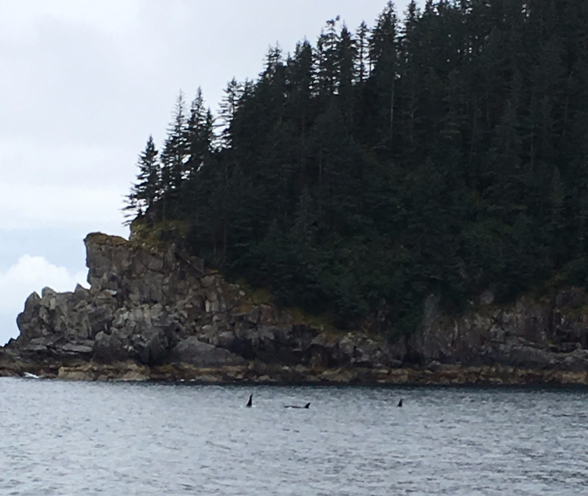
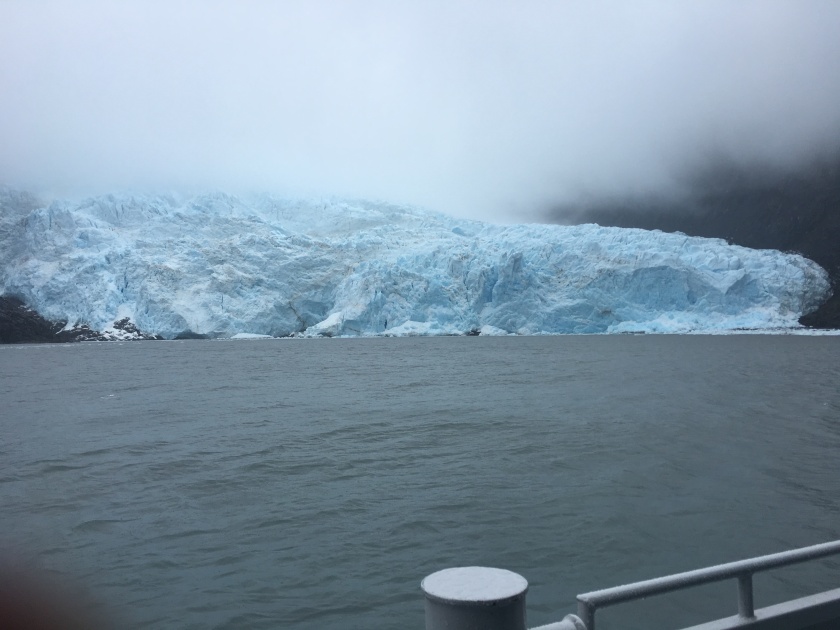
The next day I took a six-hour cruise to Kenai Fjords National Park. The rain continued, making me doubt my (pre-booked) endeavor. I talked to a shopkeeper and he said he’d been living in Seward for twenty years and had never seen as much rain as that year. However, the boat was full and we actually saw quite a lot that day – seals and sea lions, whales (orcas and humpbacks), birds, and the main attraction – glaciers.
Not my boat but a sister one – you can see that there’s lot of space inside. But sometimes you just had to get outside for the best views. It was worth it though.A pod of orca whales – we got to watch them for quite some time.The Holgate glacier – I still can’t believe how close we were able to get (despite how much the ice had receded in the last few decades)
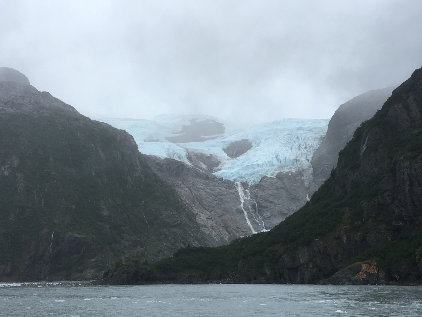
And then, behind us, Surprise!
The aptly named Surprise glacier
The next day the train trip back to Anchorage was less exciting. Part of the trip was in the dark. In hindsight, maybe I should have taken an earlier bus. But I got some writing in that day. Maybe I was extra motivated because during the next two days I attended the annual writers conference by the Alaska Writers Guild. I had come across it, when I’d been researching my trip. And as the timing worked out, I figured why not.
The first day I took part in a critique of the first 500 words of a short story I had written. It was interesting as the critique was given both by a professional, for our group an editor, and by group members. My group was supportive but my piece needs more work (not too surprising).
Then on both days, I took part in presentations and talks. Do you know that 3 million books are published in the US every year? If I remember correctly something like 70% of them are self-published. So you can imagine how difficult it is to get discovered via the traditional channels. Most of the people at the conference were unpublished authors (that had one or two manuscripts ready). So they used the critiques and one-on-one manuscript reviews to hopefully get discovered by an agent or editor. Other people were attending because they had services to sell to writers or want-to-be-writers. Overall, there was a lot of selling. But also teaching by attending agents or published writers.
I’m glad that I went to the conference as it was definitely a learning experience. (Attending this conference does not mean that I consider myself a writer now. Only writing can make me that. I have been doing well on keeping up with my homework assignments for the Gotham Writers Workshop but, besides blogging, I have not been writing as much as I would like while I’ve been traveling.)
The conference completed my visit in Alaska and the next day I went south, to Canada. But my time at the Anchorage airport reminded me once more that the 49th state is different. On the PA system they talked about firearms – how to claim them. Fall is hunting season. And they had a desk specifically to ship luggage and seafood, the latter via cold storage, if desired. Guess you have to get your meat home somehow …
I will miss Alaska. And I hope to make it back one day.
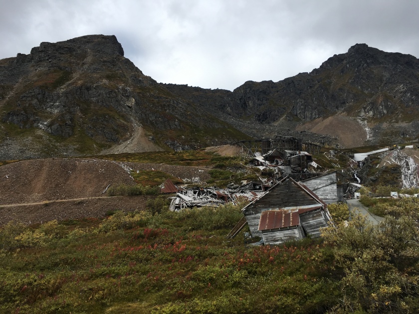
For the next couple of days, I used Anchorage as my base to explore the closer surroundings. On the first day, I went north-ish. I drove over Hatcher Pass (a dirt road but not too challenging a drive) and visited a small, now abandoned gold mining town, called Independence. The weather started off nice enough but soon turned grey and slightly rainy, making me wish I had stayed in the sunshine in Denali. A local’s comment was: It always rains in Hatcher Pass in the afternoon. I don’t believe she was kidding. The mountains around Anchorage do make a lot of rain.
A look down into the valley from Independence Mining town. They mined here from the 1890s to the 1950s. Whole families with children lived here.While some of the buildings have been completely destroyed by wind and weather, there were also some other buildings (not shown) that still look pristine. I’m not sure what made the difference.
A small lake called April Bowl
View from Hatcher Pass
I don’t believe I’ve seen as many waterfalls in as little time as I did in Alaska. (Same goes for rainbows. Although, I have fewer pictures of those.)
Thunderbird Falls, near Anchorage – back in the valley, the weather was sunny and fairly warm again.
The next day I drove to Whittier. Apparently, there is a saying that “the weather is always sh***ier in Whittier.” And so it was. It was a right soup kitchen. Apart from some nice hikes (with glacier views that I passed on because of the weather), Whittier is a starting port for cruises. But given that it was more or less post season, there wasn’t a lot going on in the town.
Whittier in the grey – it used to be quite important early on during the Cold War
One of the most exciting parts of the drive to Whittier was the Anton Anderson Memorial Tunnel that you had to take through the mountains. It was only about a lane wide and the cars drove on railroad tracks. Traffic was regulated with traffic lights and cars were only allowed to go each way about once per hour. This tunnel is the longest combined vehicle-railroad tunnel in North America. So that was really something different.
It was on this day that I saw my first salmon (or two or hundred) on their way back upriver to spawn.
In one place, the salmon (some dead) were just lying around, literally. It was a tidal river feed.
You could have picked up the salmon by hand. Or fished them quite easily. There is a quota for Alaskans, for how many salmon they may catch per day and per year. (I read today that bear eat something like 700-800 salmon a year. That’s a lot of fish.)
However, with the dead fish lying around, it was also quite stinky. Yet, the fish going upstream and dying is all part of the local ecosystem. And actually provides nutrients for the soil as well.
This was the first day for some glacier viewing. Portage Glacier was hiding in the clouds. So I hiked closer to Byron Glacier instead. Someone said with the grey weather and less sun, a glacier will look more blue. It’s something to do with which color of the light is reflected. It was impressive, either way.
Byron glacier – as with any other glacier in Alaska or Canada, you could see quite clearly they had receded significantly over time.
The next day I went to the Alaskan Wildlife Conservation Center. The thought of encountering a bear in the wild while hiking does freak me out a bit so this felt more natural. The habitats for the animals were huge (so this wasn’t quite a zoo). Most of the animals were brought to the center when they were injured or orphaned. They had bears, bison, moose, caribous, deer, wolves, porcupines, and other animals.
You could see the bears quite close from a walkway above. Viewing these fellas was my favorite part. There was also a bear cub but he hung out in a tree in his own enclosure. You could only see him because he looked darker than his surroundings. (Looking for something darker is generally also how you spot bears in the wild.)
Wood Bison from a distance – the center had already raised a herd and released them (~130 animals) into the wild in 2015, thereby reintroducing these animals to Alaska.
The drive that day took me alongside the Turnagain Arm, named so by Captain Cook because when he found that the waterway didn’t go through, he had to “turn again”. Turnagain Arm boasts the second highest tides in North America. These tides can reach 40 feet (12 meters) and come in so quickly that they produce a wave known as a bore tide. (My link is to Wikipedia but there are also clips on YouTube. Folks surf these tides.)
I saw no tides but the mudflats instead. Which are quicksand like so one could get stuck … and then when the water comes in ….
Part 4 - Seward and Alaskan Writers Conference may be found here.
Denali National Park was gorgeous in its fall colors. I got lucky and saw some of the “big five” animals (bears, caribous, moose, Dall sheep, wolves).
Note: Part 1 - Anchorage and Fairbanks - may be found here.
I visited Denali National Park during the first full week of September. This meant two things – 1) buses would only be going into the park for one more week (and some restaurants/ lodges were already closed for the season) and 2) it was fall. Fall is only about two weeks long, so it turned out to be a really great time to visit – once the weather cooperated.
As I was driving towards Denali NP, I had my doubts as the weather was grey and rainy (and the forecast for the day after next was light snowfall) …… but it then turned into this. Look at the rainbow (in the center, at the lower end of the mountain on the left).
The vast majority of Denali National Park is only accessible via bus tours or back country hiking. However, you can drive about 15 miles into the park, to a place called Savage River. So that’s what I did my first afternoon. And what do you do when the rain stops? You go on a hike. Or two.
Aren’t the colors gorgeous? Savage River is narrower here than at the trail head for the loop. There it’s a braided river.
Because I wanted a bit more of a view (and the trail was right there), I scaled Mountain View. I felt like a goat. No wonder, the elevation change on that path was 1,500 feet. But the view was worth it.
Panorama View from the Mountain ViewNon-panorama view into the valley – this is the part of the park you can drive thru.View further into the park. You can see the road the buses take.
I also saw animals that first afternoon. Small …
A Hoary Marmot – little fella kept right on chewing on his piece of grass
… and not so small.
One of three moose I saw that day. When this big fella lowered its head, I did not feel completely safe in my car. Apparently, the road leads through a rutting area for the moose, so it’s quite common to see them there.
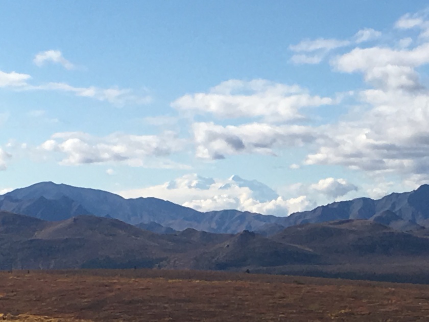
The next day I took a bus tour into the park and finally saw Mt Denali, even if from about 50 miles away.
The white just above the mountain ridge is not a cloud (or not only) but it’s snow-covered Mt Denali peaking out. Look for an angular peak. Mt Denali’s second peak is hidden in the clouds.
In case, you are confused whether it’s Mt Denali or Mt McKinley. Denali is the original name the Alaskan natives gave this double-peaked mountain. It means “the high one” which is very appropriate as – with a height of 20,156 feet (6,144 m) – it is the highest peak in North America. Mt McKinley became the official name in the early 20th century. It was named to commemorate president McKinley after he was assassinated. However, Denali remained the name commonly used in the state so the Alaskans petitioned congress to change the name back. It took congress from 1979 to 2015 to approve this request. A congressman from Ohio, from the district where McKinley had spent most of his life, blocked the request from 1979 to 2009, and then it took another six years for a renewed effort to go through, once he retired.
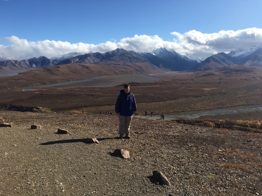
At one of the stops during my six hour bus tour – essentially about four hours into the park, with sightseeing stops, and then about two hours out. All on the one road they have at Denali. There are longer bus tours but I didn’t feel like sitting for longer.
At Toklat, the turning point. I don’t believe that I’ve heard the phrase “braided river” before visiting Denali National Park. It is just what the name implies – a river with multiple stream running like braids in a very wide riverbed.
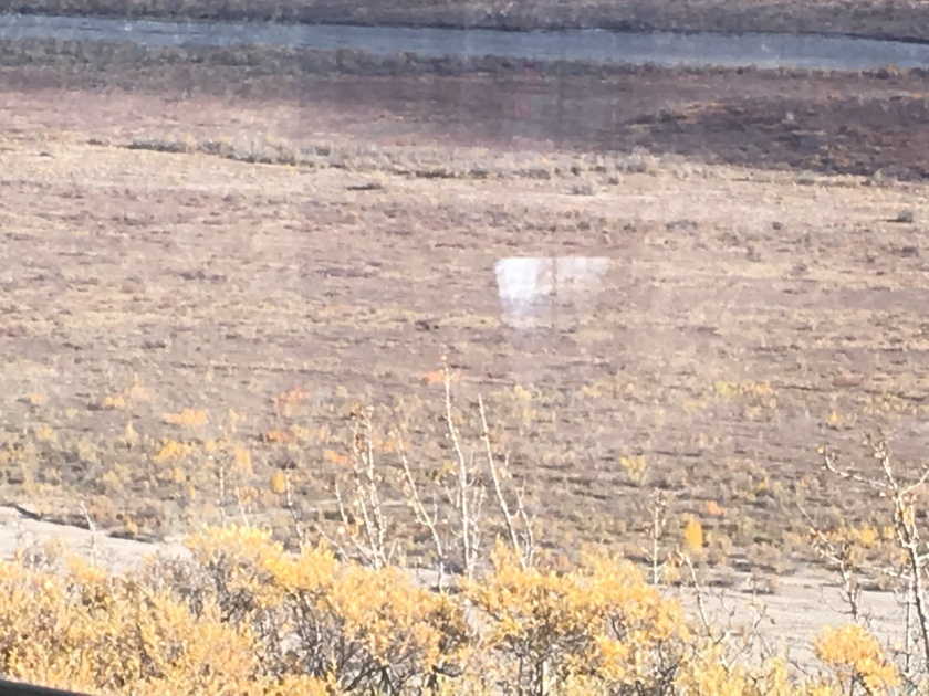
Can you spot the bears (mama bear with two cubs) in the middle of the picture, left of the “window”? We also saw moose (up close), caribou and golden eagle (from a distance) so I was doing quite well in regards to seeing the local wildlife.
During the night, I tried seeing the Aurora Borealis. It was supposed to be a great night for it, given recent large sun flares that were just about to reach Earth. However, the sky above Cantwell stayed cloudy. So I settled for a sunrise instead.
Sunrise as seen from Cantwell, about 30 minutes drive south of the national park. What you can’t see in the picture is that behind the puddles is an airstrip and behind me is the small plane that belonged to the B&B owners. The plane was parked in front of their house, just like that. (Well, it’s a dirt road. Their house is the only one on it. But still …)
Before leaving Denali NP, I had time for just one more hike – up to Mt Healy, with 1,700 feet elevation gain but this time over two plus miles. This was the day when it was supposed to have snow fall. It was t-shirt weather instead. I heard at some point that you shouldn’t trust an Alaskan weather forecast that is more than a day out. Not sure how you ever plan anything but it seemed to be true. (One of my Uber-drivers later said that you just pack for any circumstance.) Given how nice the weather was, I didn’t really want to leave the park but Anchorage called again.
View back over the entrance of the park. Notice the yellow fall colors in the valley. They’ll be gone in another week as fall only lasts about two short weeks in Denali.Saying good-bye to Mt Denali on the three-hour drive back to Anchorage.
A couple more things, I’ve observed driving in Alaska. They have “no shooting” signs on the road. Someone told me that you aren’t allowed to fire a gun but an arrow if you’re on the road. And there was one occasion where I passed a truck going about five miles an hour. I’m sure they were hunting. You would expect “Moose crossing” signs. But I also saw “Dog team crossing” signs. That was unexpected but made sense, once I thought about it. And then seen while parking, cars with a power plug hanging out the front grill. Lots of them.
Go visit Alaska, if you get a chance. This first post on Alaska talks about its remoteness but also its beauty. More to come.
My two weeks in Alaska started in Anchorage. Ca. 300,000 people, almost half the population of the state, live in this city by the Cook Inlet. Given that Alaska is the largest US state, this provides you a feel for how sparsely populated the 49th state is.
I heard a story about kids taking a plane (yes – a small airplane) to school instead of a school bus. Apparently, there is only one school like this in the whole US (these days) but the town is so remote, there is no choice. Kids also have a choice of getting their pilots license (for free) in high school. I’m not sure if that’s true for all Alaskan high schools anywhere but could imagine it is … given there are large parts of Alaska that are only accessible by plane. Per the internet, it’s something like 80% of communities that aren’t connected to a road or railway. So one in about 58 residents has a pilot’s license. I also heard that a lot more people than that fly, i.e. without license.
When you drive in Alaska, you see airstrips (and lakes used for seaplanes) everywhere. One of the B&Bs that stayed in came with the description look for the red-and-white plane in the front yard. It was the functional plane of the owner.
Despite Anchorage’s size (but maybe not surprising after what is written above), there is more or less only one road into town from the North, and one out of town towards the South-East. During a sightseeing tour I was told that about 40% of the small planes registered in the US are in Alaska and that a lot of them are at Lake Hood, a seaplane base near Anchorage’s airport. Lake Hood has the world’s largest seaplane base, handling an average of 190 flights per day. Can you imagine?
Places visited during my stay in Alaska – with driving from Anchorage to Denali NP to Fairbanks (and back) and a train trip to Seward. In between, I also undertook a day trip to Whittier (between Anchorage and Seward).The city of Anchorage, as seen from the Tony Knowles Coastal Trail, and framed by the Chugach Mountains and the Cook Inlet which leads into the Turnagain Arm.
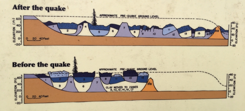
I used my one day stop-over in Anchorage to hike a large part of the Tony Knowles Coastal Trail. During the hike, I learnt about the world’s second-largest earthquake (a 9.2 on the Richter Scale) which severely affected Anchorage and other towns on the Kenai Peninsula. This Good Friday earthquake occurred in 1964. It led to parts of the Anchorage shoreline sinking and a whole neighborhood sliding into the sea. Thankfully, the number of casualties was very limited, given the timing of when the quake occurred.
Earthquake Park – where the neighborhood of ~70 houses used to be. You can see the unevenness of the ground, caused by the landslide during the 1964 earthquake. It was a great park with lots of explanations of what happened during the quake and how it affected not just humans but also plants, e.g. who suddenly found themselves at a ninety degree angle after the slide or buried altogether.A visual of the landslide that happened. Notice the drop in elevation. If you imagine a house on a carpet that a giant pulls, you have an approximate image of what went on. Hard to imagine.
The next day I drove 6 hours to Fairbanks. For about four of those hours, I was headed towards a mountain range, the Alaska Range. Once I’d crossed over (or rather through) that mountain range, it was interesting how the weather changed. The clouds sometimes hang in the mountains, leading to rain in one place and much nicer weather just a few miles away. This also makes the weather forecast almost useless. During my three-day stay in Denali, they didn’t get it right for a single day. And where off by quite a margin as in “snow flurries” v “t-shirt weather with sunshine”.
A look of the mountain range near Denali National ParkAnd another scenic view from the road — this is fall in / near Denali which lasts about two weeks. Very pretty, in my opinion.As a panorama view – the clouds really made the view even more interesting.
For those of you wanting to hear even more about the remoteness of Alaska, there were miles and miles on the highway (and this is one of the three major Alaskan ones – Route 3) were I was all alone. And then there were other miles where I kept following the same car. Not because I couldn’t pass – Alaska’s highways often have a passing lane every few miles – but because we had similar speed and there just weren’t any turnoffs from the highway. So all you could do is follow – or turn into a scenic parking spot to take some more pictures.
A picture taken once I’d crossed the mountain range so this is North of Denali on the way to Fairbanks. Notice how flat it is.
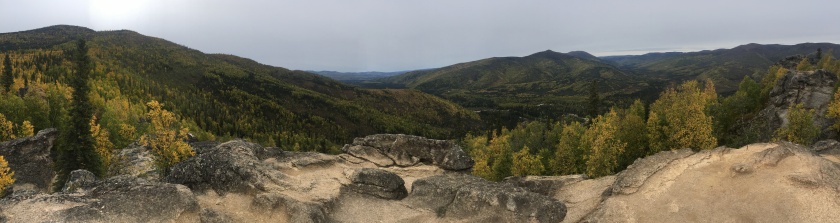
Fairbanks is a tiny city further North, best known as a launching point to go on a trip to see the Northern Lights or to drive to the Arctic Circle. As a trip to the Arctic Circle would have meant another day of all-day driving (and on a mostly gravel road), I decided to go hiking instead. My hike around Angel Rocks was great.
Scenic View from Angel Rocks hike.
A visit to the Museum of the North at the University of Alaska Fairbanks rounded out the day. They had the obligatory stuffed animals (more pictures of living animals later in this blog) but also a lot on the history of different Native Alaskan tribes as well as a section on what happened during WWII – remember Alaska wasn’t a state yet. But the territory was seen as critical for the war effort.
And then they had this …
Part 2 - Denali National Park - may be found here.
It was a long trip to Tennessee to see the solar eclipse on Aug 21. But being able to experience the totality was well worth it. If you get the chance, go and see an eclipse.
On August 21 the solar eclipse crossed the continental US. I was in Tennessee under the path of the totality. In order to get there I had driven in one day from New Hampshire to Virginia. That took twelve hours of almost continuous driving. I’m not ever going to do that again. The fact that I even did it once shows how much my attitude towards driving long distances has changed. Driving six hours used to be a really big deal. In Europe.
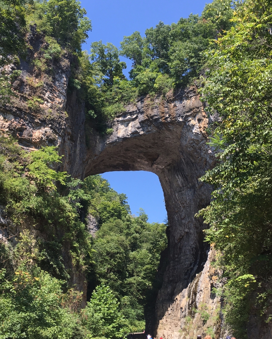
Then on August 20 two friends and I traveled to Pigeon Forge, TN. Thankfully, a friend was driving. On the way there, we stopped at the Natural Bridge. That is an amazing sight. I can only recommend a visit. When we left, we also drove over the bridge. Yes – there is a road up there. Thankfully, you cannot look down as you are crossing.
The Natural Bridge in Virginia
While at the Natural Bridge, we also took a short walk to the Lace Waterfall. Very pretty. And looked at a recreated Native American village (no pictures).
The Lace Waterfall – so named for the shape of the water
With that and another stop for food, we ended up spending almost another twelve hours on the road. Thankfully, it wasn’t all driving. As we got closer to Tennessee, we tried to find a place to get glasses for the eclipse. We did not have any yet as they had been sold out for weeks. A place called MagiQuest (I’m not making this up) was supposed to have some. Alas, when we got there, they had sold their last pair two hours before we got there. (We did not regret our stop at Natural Bridge though.)
So that night, it was “arts and crafts” time. A friend created viewers from cereal boxes. The next morning we stopped by one more place that we had heard might have glasses but that had been closed the night before. And they had them. For $20. We took them. The place was called “As seen on TV”. It looked inside as you would imagine from that name.
Now properly equipped, we went on the hunt for a good spot to see the solar eclipse. We had abandoned our plan to see it from the Great Smoky Mountains National Park. Traffic was supposed to be horrible in the park. So we ended up driving South-West. Along the highway we saw signs of people renting out their fields for parking (most of them really tiny but with hefty prices) but we drove on. We finally joined hundreds of others on a field in Tellico Plains, TN. The National Guard was helping with the parking. There was a bit of an event at the local library. It was well organized. Tellico Plains temporarily increased in size, significantly.
What was great about being on that field was that it was a group of like-minded people. Everyone was friendly. You could lend something to your neighbor, e.g. a blanket as we did for sun cover, and not be worried about them not giving it back. It was a community and everyone was looking forward to the event.
For ninety minutes we watched the moon move in front of the sun. Our viewers worked but the eclipse glasses were more impressive. Nevertheless, it was nice to have the viewers as you could look into them by looking down so you could relieve your neck or you could look into them from the front seat of a car when we were inside for the AC as it was 111 degrees Fahrenheit at some point.
Cars parked on a field in Tellico Plains, TN
Cars just before the eclipse – notice the color change?
Notice the color change in the pictures above?
The anticipation was tremendous. We discussed if the temperatures would fall (seemed a given – and it did), if we could see the moon’s shadow and from which direction it would come (couldn’t agree on that one; and the darkness eventually seemed to come from multiple directions as opposed to a clearly demarcated shaped shadow), if people would scream (they yelled with joy – v screaming in fear) … When the time came the colors changed. It didn’t just get darker but everything took on a metallic sheen. It was like dusk in the middle of the day, not full night. You could still see. One some levels it was like a night with a full moon. These days whenever I look at the moon, I remember the build-up to the totality as the sun did look so much like the moon.
Unfortunately, my totality pictures aren’t great. I didn’t use a filter so the sun looks normal. But both pictures below are taken during the totality. It lasted for over two and a half minutes where I was. One of the longest durations that day.
During the totality (without filter)
During the totality – we saw a couple of stars
Seeing the solar eclipse was great and I won’t soon forget it. If you get a chance in the future, go and see it. It is well worth it.
What was strange for me was that immediately after the totality, people started leaving. Something that had been special, i.e. the ninety minute build-up, was now not worth the “mention”. We left soon too and made our long way back to Pigeon Forge. There was a lot of traffic that afternoon (and the next day on our way back to VA).
I took some pictures of Pigeon Forge, TN, as we were leaving. Parts of this small town looked like the Strip in Las Vegas, especially at night, when it’s all lit. I’m not kidding. Although, it only had about half the personality. Commercialization run amok.
King Kong climbing a skyscraper (to the left of the big board)
The Titanic and “its” iceberg (a museum)
Lots of dinner entertainments. Here a Hatfield and McCoy example.
Back in Virginia, I was lucky enough to catch up with old workmates. I was able to attend a promotion celebration lunch for one of my directs. (Congrats again.) I’m glad that I could make it. It was great catching up. I also saw a few other friends before I had to leave for DC. A friend of mine was moving and had a very narrow window for a visit. Thus started my slow trek up north. With a stop in Connecticut, it took me over a week to make my way back to New Hampshire. And then less than forty-eight hours later, I was back on the road. More to come about my first days in Alaska. It’s a wonderful fall season here.
I started traveling again. For the next six weeks, I will be visiting Alaska, Alberta and BC in Canada, and the Pacific Northwest.
I am on the road again. The length of this trip is about 6 weeks.
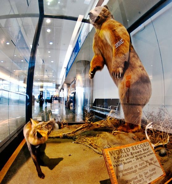
Grizzly Bear at Anchorage Airport, Alaska
I will be in Alaska from now to Sept 18. Planned stops include Anchorage (where I am now as I’m writing this), Fairbanks, Denali National Park, Seward, and Kenai Fjords National Park. Then I will be flying to Calgary for a visit to that Canadian city along with Drumheller Dinosaur park, Banff, Lake Louise, Jasper, a 27 hours train ride, and Vancouver. That will take me through the end of September. The last stops on my trip will be in the Pacific Northwest, starting with Seattle and Mt. Rainier, Portland, and then points South on my way to San Francisco. I’ll be flying back to the East Coast in mid-October.
During this trip, I’m hoping to get back into my habit of a weekly blog post.
PS: I also need to share pictures and experiences from my trip to Tennessee. We saw the Totality on Aug 21. It was amazing – both the 90 minute build up and the 2 and a half minute darkness when the moon covered the sun.


")